Norbu Kang Peak Climbing

Norbu Kang Peak Climbing (6085 meters) is in the lower Dolpo region and is a fairly easy and one of the less-frequented climbing peaks available for climbing in the Dolpo region of Nepal. This is one of the peaks that can be a good starting for people who aspire to climb mountains in the Himalayas of Nepal.

The peak lies in between the famous Shey Phoksundo and the Dho Tarap region of the lower Dolpo. The trail follows the Numa La and Baga La Pass trail is only separated from the Danigar to head towards the mountain. The base Camp of Norbu Kang Peak can be reached a day from Denigar. The summit of Norbu Kang can be reached within a day from the Base Camp and no higher camps are required. The climbing is also on a fairly comfortable slope and with some assisted fixed lines it can be a good climbing experience for someone wishing to climb above the 6000 meters.

Norbu Kang Base Camp.
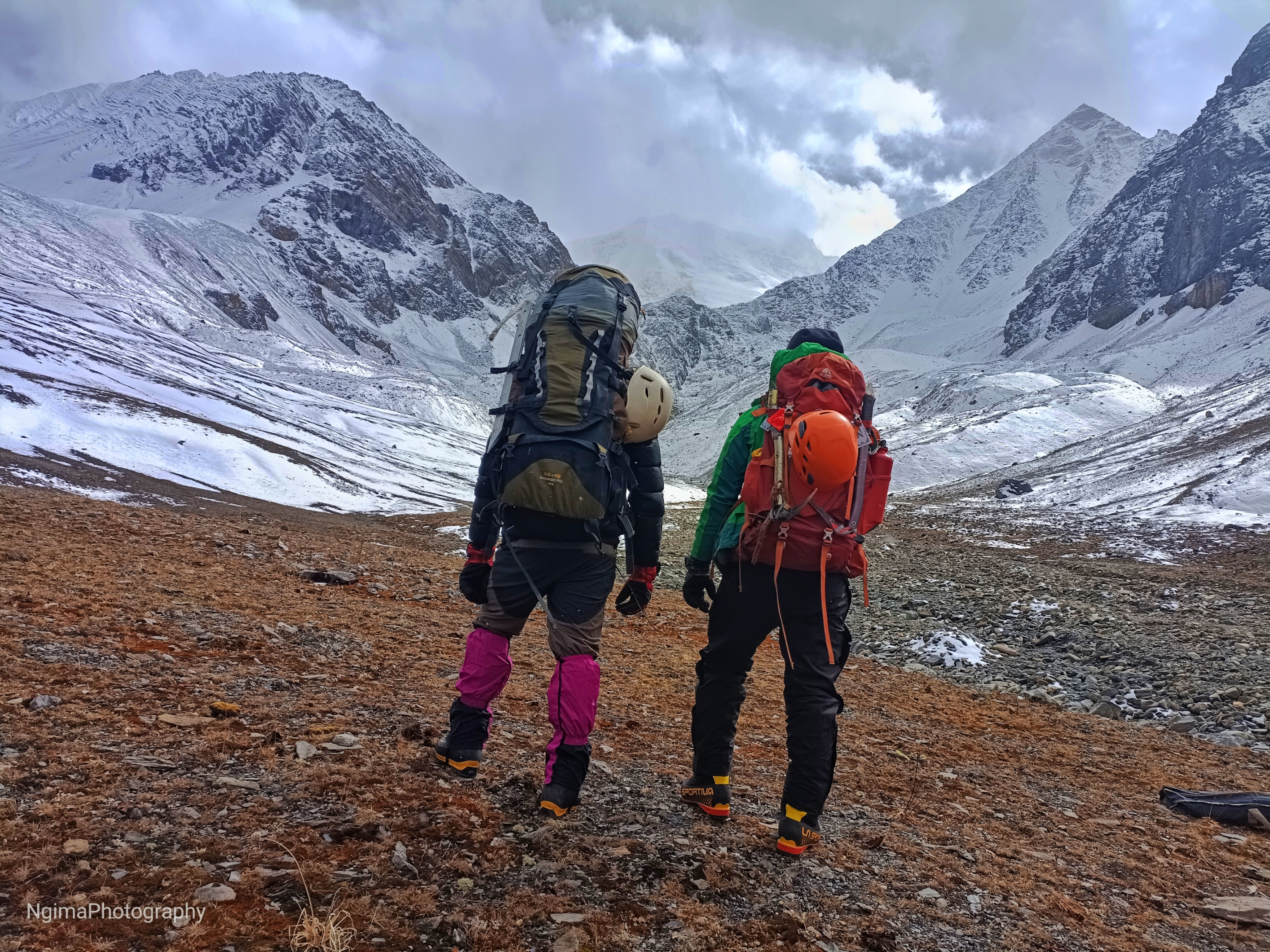
Ngimakaji and Ramesh are ready to climb Norbu Kang Peak. They are looking towards the climbing route.


Visit Himalaya Treks operated the Norbu Kang Peak Climbing and Trekking expedition from October 9 to October 30, 2023. Unfortunately, due to adverse weather conditions, the team was unable to reach the summit of Norbu Kang Peak. Nonetheless, the team completed the upper Dolpo Trek following the Upper Great Himalayan Trail route.

Visit Himalaya Trek organizes and makes all the arrangements for climbing the mountain. The trek and expedition crew are highly qualified and trained personnel with a good decade-long experience of climbing and trekking in the Himalayas of Nepal.

Our Campsite at Dolpo Trek
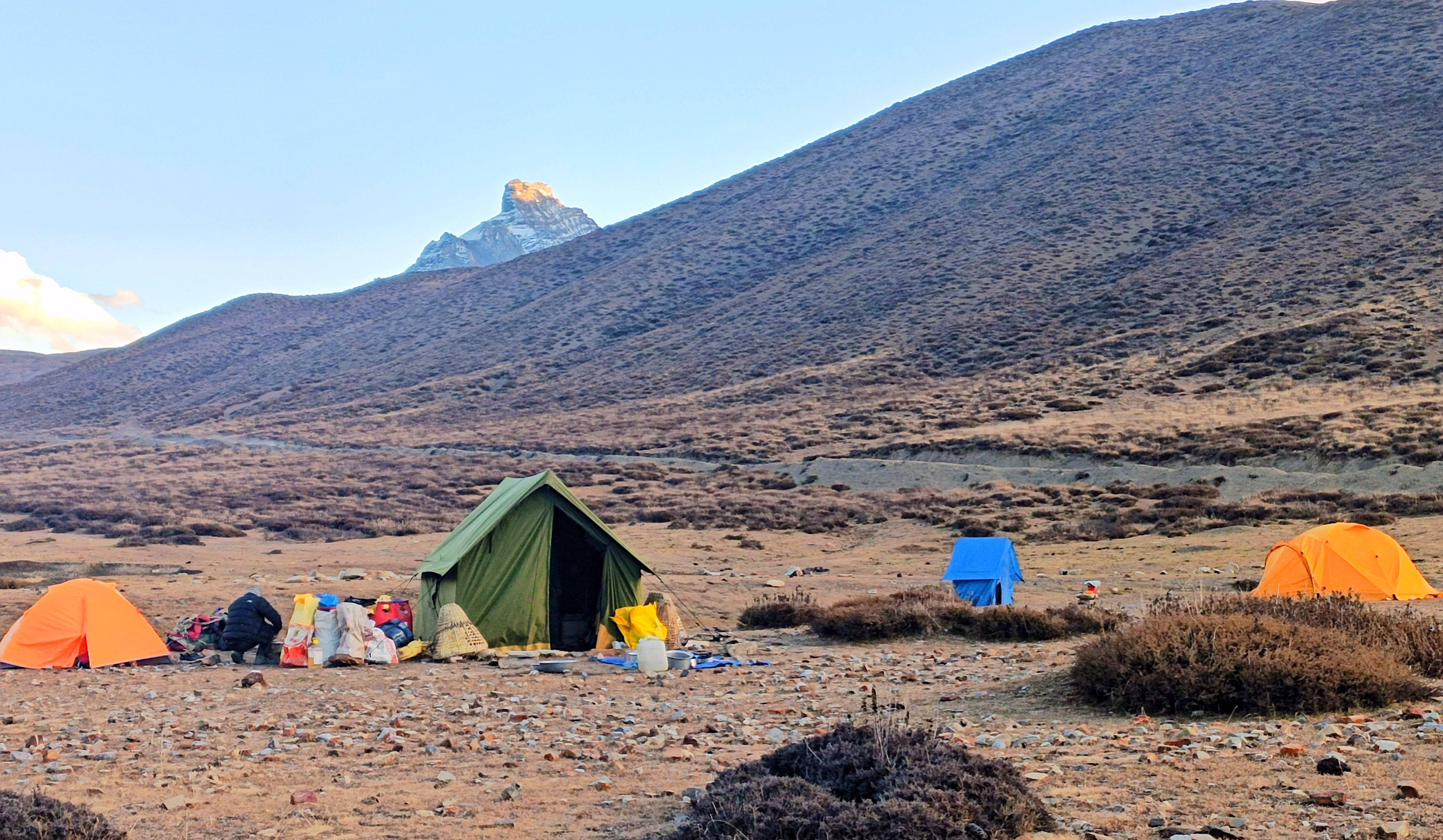
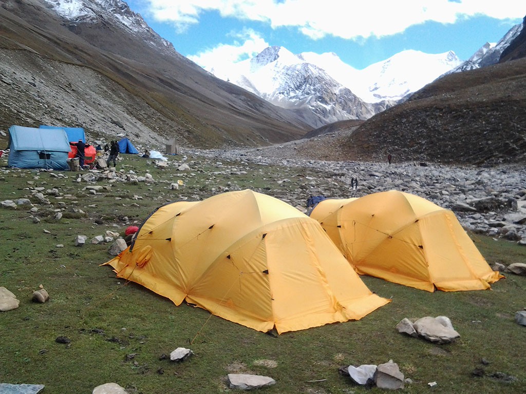
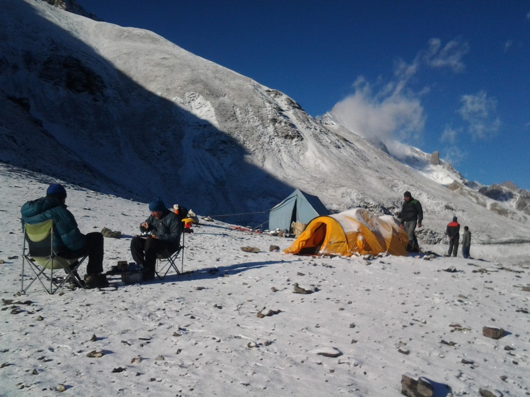
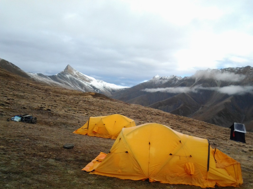
Our Campsite at Upper Dolpo Trek in Nepal

Norbu Kang Peak Climbing Trip Short Itinerary,
Day 01:
Arrive in Kathmandu. (1335 meters)
Day 02: Sightseeing and Trek Preparation.
Day 03: Fly to Nepalgunj. (130 meters) stay overnight at a hotel.
Day 04: Fly to Juphal (2490 meters) and trek to Lingdo (2391 meters) at Camp.
Day 05: Trek to Laina Odar. (3770 meters) stay at Camp.
Day 06: Trek to Sim Odar (Taltol) (3523 meters) at Camp.
Day 07: Trek to Dho Tarap (3944 meters) at Camp.
Day 08: Acclimatization day at Dho Tarap (3944 meters) at Camp.
Day 09: Trek to Numa La Base Camp. (4440 meters) at Camp.
Day 10: Cross Numa La Bhanjyang to Danigar (4512 meters) at Camp.
Day 11: Trek to Norbung Kang Base Camp (5500 meters) at Camp.
Day 12: Climbing Preparation Day at Norbung Kang Base Camp (5500 meters) at Camp.
Day 13: Climb Norbung Kang (6085 meters) and back to Base Camp.
Day 14: Trek back to Danigar (4512 meters) at Camp.
Day 15: Cross Bagala Bhanjyang (5224 meters) and trek to Yak Kharka. (3982 meters) at Camp.
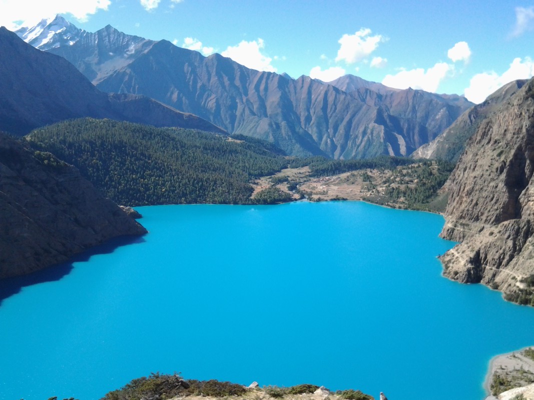
Day 16: Trek to Phoksundo Lake (3733 meters) at Camp.
Day 17: Rest day at Phoksundo Lake (3733 meters) explore beautiful Phoksundo Lake and around stay at Camp.
Day 18: Trek to Chepka (2838 meters) at Camp.
Day 19: Trek to Juphal (2475 meters) at Hotel, Tea House.
Day 20: Fly to Nepalgunj continue connecting flight to Kathmandu and stay overnight at KTM Hotel.
Day 21: Free day in Kathmandu at a Hotel, Rest and last-minute shopping.
Day 22: Departure.

Norbu Kang Peak Climbing Detail Itinerary

DAY
  • 1

    A representative from Visit Himalaya Treks Pvt. Ltd. trekking with the company’s display board will greet you outside the arrival terminal and transfer you to your Hotel.

    Altitude 1335 m
    Meals Breakfast
    Accommodation Hotel
  • 2

    A full day guided tour to several of historical and spiritual attractions enlisted under the World Heritage Sites. The trek leader will meet the group for a meeting and provide a detailed briefing on the trek. All the required information regarding the trek would be provided.

    Altitude 1335 m
    Meals Breakfast
    Accommodation Hotel
  • 3

    The mornings can be used to carry out some last minute re-checks as we have an half an hour afternoon flight to Nepalgunj. Landing in Nepalganj transfer to Hotel stay overnight at Hotel. 

    Altitude 130 m
    Meals Breakfast, Lunch, Dinner
    Accommodation Hotel
  • 4

    An early morning 45 minutes flight lands us on Juphal and after a brief sorting and introduction of our crew, the trek finally starts. The trek heads toward Dunai, administrative headquarter of Dolpo, and then continue to follow the Bheri river all the way to Lingdo.

    Altitude 2391 m
    Meals Breakfast, Lunch, Dinner
    Accommodation Camp
  • 5

    The trail is the newly built road and stays on it all the way to Laisicap. The first two hours of the day is a comfortable trek and after that the trail starts to climb steeply snaking the ridge. After 30 minutes trek, trail briefly drops to Laisicap. The trail now crosses the river and then stays gentle for next 20 minutes. Now, trail gets away from the road and climbs steeply, briefly getting back on the road. The climb lasts for an hour and a chorten marks its end. A brief gentle flat walk of 10-15 minutes is again followed by a steep climb for the next hour. The trek is now in a narrow valley and undulates for most of times with more climbs than downhill. It takes around 2 hours from the chorten to Laina Odar. 

    Altitude 3770 m
    Meals Breakfast, Lunch, Dinner
    Accommodation Camp
  • 6

    A steep continuous climb lasts for a little more than an hour. Then the trail continuously undulates with small sections of descends and ascennds. Tghe valley is very narrow for most parts of the whole day. Finally after 3 hours, Chyuggar can be seen from a ridge and a small brief descent finally leads to Chyuggar. It is a small resting place with some small teashops by the river. A comfortable hour with again small ups and downs takes to Nawarpani (another small rest stop like all other places with couple of tents) and a similar half an hour leads to Sim Odar. Sim Odar is a flat place at the river banks with couple of Odars (a shelter beneath an overhang) 

    Altitude 3523 m
    Meals Breakfast, Lunch, Dinner
    Accommodation Camp
  • 7

    The trail undulates for the most part in the morning and arrives at Toltol after an hour. The valley is quite narrow and trails keep undulating following the river. After around 3 hours the trail crosses the river and a steep 10 minute climb leads to Kesi La. After Kesi La, a drop is briefly leads to a bridge and again continues to follow the valley which is starts to be a little more wider. Another bridge follows (lots of tiny caves by the river) and a gentle climb leads to another set of prayer flags. This second prayer flag is an hour away from Kesi La. A wider valley appears after the prayer flags and a long comfortable walk of around 4 hours by the stream ends at Dho Tarap.

    Altitude 3944 m
    Meals Breakfast, Lunch, Dinner
    Accommodation Camp
  • 8

    The day is used to do some acclimatization hikes around Dho as the trek enters into higher elevation in the next few days. There are several monasteries around Dho Tarap. A Bon Monastery in nearby village is one of the highlights to visit of this acclimatization day. 

    Altitude 3944 m
    Meals Breakfast, Lunch, Dinner
    Accommodation Camp
  • 9

    There is a big wide main trail that passes through Crystal Mountain School followed by Taksi village. It takes an hour to pass through Taksi from Dho Tarap. Another hour on the same trail takes through another small village of Tokyo. The trail starts to turn into a gentle climb and also leaves the main trail and the valley behind. After one more hour, a small stream and a wide valley appears on the left side of the main valley coming from Dho. (Some groups consider it Base Camp and camp by the river.) 

    Altitude 4440 m
    Meals Breakfast, Lunch, Dinner
    Accommodation Camp
  • 10

    The steep climb continues on the ridge and after 30 minutes, a brief traverse starts. Another ridge and another steep ascend follows for the next hour. The climb ends at Numa La Pass (5309 meters)  Numa La Bhanjyang offers views of Dhaulagiri Range to the East and Kagmara Range in the West. A steep descend into the main valley leads to a small stream in the bottom of the valley. The trail briefly stays with stream until it reaches a fork. Here, the trail crosses the river heads towards the left valley. A small gentle uphill traverse ends at Danigar. Danigar is a pasture at the end of the valley surrounded by towering ridges. Norbung Kang is a prominent peak among these ridges that surround Danigar. 

    Altitude 5309 m
    Meals Breakfast, Lunch, Dinner
    Accommodation Camp
  • 11

    The trek separate from the main trail of the Lower Dolpo Trek and now directly heads towards the norbung Kang Base Camp takes about 6 hours. 

    Altitude 5500 m
    Meals Breakfast, Lunch, Dinner
    Accommodation Camp
  • 12

    Climbing Preperation day, Check gears and our climbing guide will provide short climbing training stay at Camp. 

    Altitude 5500 m
    Meals Breakfast, Lunch, Dinner
    Accommodation Camp
  • 13

    The day is one of the longest and the hardest day of the trip. The climb itself is straightforward on a comfortable slope and takes around 7 hours to get to the summit of Norbung Kang Peak (6085 meters). After the summit, the descent continues to the base camp.

    Altitude 6085 m
    Meals Breakfast, Lunch, Dinner
    Accommodation Camp
  • 14

    Following the same track we walked earlier trek to Danigar. 

    Altitude 4512 m
    Meals Breakfast, Lunch, Dinner
    Accommodation Camp
  • 15

    The day starts with a steep climb on the ridge seen directly from Danigar. Steep climbing continues for around 2 hours and reaches a spot with some mane stones. After the spot, the steepness decreases (yet still difficult) and a traverse towards the top of Bagala starts. It takes around 40 minutes to reach Baga La from the spot with mane stones. The descend after Baga La Pass (5224 meters)  is a bit rough and goes through boulders and scree. After an hour, a valley opens up and the trail starts to follow a stream. The stream snakes through the valley and after less than an hour, the trail moves away from the stream and starts to drop very steeply to Phedi. The descend continues farther than Phedi and then changes into a comfortable and gentle trek towards the end of the day. Yak Kharka is an hour away from Phedi. It is a wide seasonal pasture for the locals also has a couple of houses. 

    Altitude 3982 m
    Meals Breakfast, Lunch, Dinner
    Accommodation Camp
  • 16

    After leaving Yak Kharka, the trail comfortably traverses for half an hour. Then slowly, a steep climb starts and lasts for almost more than an hour until it reaches a stop with a prayer flag. Now, the climb eases and a huge waterfall appears on the opposite valley. Juniper trees and some fields appear near the trail and soon Rigmo village is seen. A bridge to cross the Phoksundo River flowing out of the Phoksundolake marks the entry to Rigmo village. The campsite lies just outside of Rigmo village and right next to the Phoksundo Lake. 

    Altitude 3720 m
    Meals Breakfast, Lunch, Dinner
    Accommodation Camp
  • 17

    The day can be enjoyed by the side of the majestic lake. There are also few monasteries in the village for day visits. 

    Altitude 3720 m
    Meals Breakfast, Lunch, Dinner
    Accommodation Camp
  • 18

    The trek now starts to go through the valley carved by Phoksundo River. Around 2 hours of descent leads to Jharana Hotel. Now the trail stays with or near Phoksundoriver until the end of the trek. A comfortable trek with small ascends and descends takes through a small settlement of Rechi. The whole day after Jharana Hotel is in a narrow valley. After Rechi it takes around 3 hours to reach Chepka. Chepka is a bigger and wider place compared to Rechi. 

    Altitude 2838 m
    Meals Breakfast, Lunch, Dinner
    Accommodation Camp
  • 19

    The trek follows the same pattern as of the previous day and continues in the same valley. The trail goes through small settlements of Sangta and Kageni en route to Sulighta. Finally the valley widens up after Sulighat and the trek head towards Dunai by the bank of Bheririver. The trail follows Bheririver and there is a final climb of around an hour to reach Juphal, the ending point of the trek. 

    Altitude 2475 m
    Meals Breakfast, Lunch, Dinner
    Accommodation Camp
  • 20

    A morning flight to Nepalgunj is followed by an evening flight to Kathmandu. 

    Altitude 1335 m
    Meals Breakfast, Lunch
    Accommodation Hotel
  • 21

    Also an extra day in case of delays or cancellation of flights.

    Altitude 1335 m
    Meals Breakfast
    Accommodation Hotel
  • 22

    A representative from Visit Himalaya Treks Pvt. Ltd. will check your flight tickets and transfer you to the airport before two hours from your flight with a hope of seeing you again in the future. 

    Altitude 1335 m
    Meals Breakfast
    Accommodation No

Cost Includes

    • Airport transportation, Arrival, and departure Land transport.
    • Standard hotel accommodation in Kathmandu on B/B plan
    • Kathmandu - Nepalganj - Juphal and Juphal- Nepalganj - Kathmandu domestic flight.
    • Experience climbing Sherpa and Guide.
    • Climbing gears like rope, ice bar etc for the Norbung Kang Peak Climbing.
    • Norbung Kang Peak Climbing permit and all government taxes.
    • Garbage deposit fee.
    • Full board high altitude meal while trekking to base camp and climbing Period.
    • Guide, Cook, support crew and porters with their equipment, daily wages, food, insurance etc.
    • All necessary camping and kitchen equipment provided that includes base camp tents, dining tent with table and chair, kitchen tent, toilet tent.
    • Good quality high altitude tents while climbing the Norbung Kang Peak.
    • Emergency Oxygen with regulator and mask.
    • EPI gas and burner for the high climb;
    • Satellite Phone and Walkie-Talkie in case of emergency

Cost Excludes

    • Nepal entry visa fees
    • Lunch, Dinner in Kathmandu
    • Personal equipment and climbing gears.
    • Medical and personal high-risk insurance.
    • International airfare and airport tax.
    • Climbing Bonus, tips, and personal nature expenses.
    • Applicable permit fees and customs charge for Sat phone, communication equipment, and commercial filming while on Norbung Kang Peak Climbing.

Cost & Date

Start Dates are your arrival date in Nepal and End Dates are the returning date from Nepal.

The set departure dates listed are specially quoted and specified for group joining option. Let us know if the set departure dates are not suitable for you- another dates which are suitable for you can certainly be added by us.

Upcoming Trip Departure

  • Guaranteed - Trip is Guaranteed to run
  • Available - Trip is available to run if minimum group size is filled
  • Limited - Only few space available
  • Booking Closed - Maximum group size is filled

Check Available Dates

Trip Start Date Trip End Date Price Status Book

Looking for a personalized experience? We organize a privately guided trip designed to fit your taste and interest. Please fill out the form below to get started.

Reviews ( 0 Reviews For This Package )

FAQs

$ 4800 / Person
BOOK NOW
22 Days Nepal
TRIP OVERVIEW
Norbu Kang Peak Climbing
Altitude 6085 m
Norbu Kang Peak Climbing
Region Dolpo Region Of Nepal
Norbu Kang Peak Climbing
Difficulty Extreme grade
Norbu Kang Peak Climbing
Group size 2+ Peoples
Norbu Kang Peak Climbing
Best Season October - November in Autumn season & March - May in Spring Season

QUICK INQUIRY